Dijon, France/dijon550
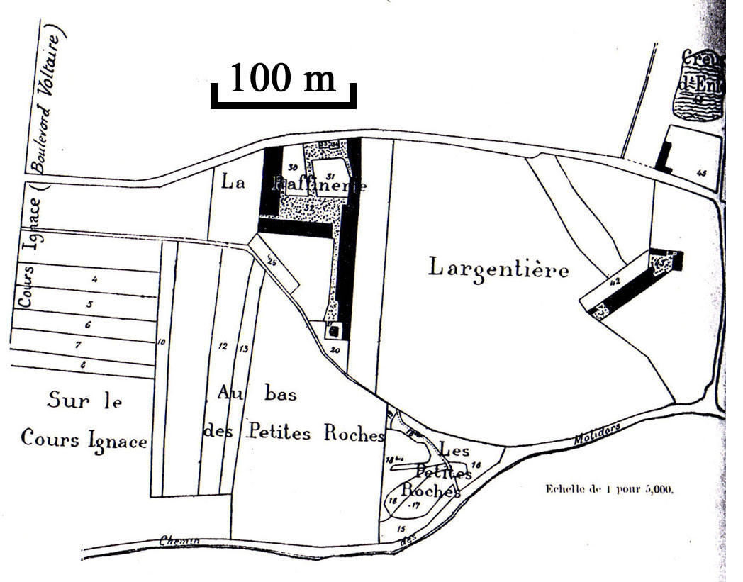
Previous | Home | NextThis is a map of the La Raffinerie de Salpêtre [refinery of saltpeter] des Argentières, dated 1812 (le plan cadastral). Orientation is normal (north is up). The saltpeter refinery itself is the oldest in Dijon, dating from 1582. Bernard Courtois' older brother Pierre ran this refinery during the beginning of the 19th century. Its production was never as great as the Saint-Médard facility (run by the father Jean-Baptise Courtois; see below). Buildings are portrayed by solid black. This map can be matched with the Dijon map ("3"). The north-south road at the extreme left was named Cours Ignace, but is now named Boulevard Voltaire. The east-west road at the bottom was named Chemin des Molidors but is now named Chemin des Petits Roches (road of little rocks).The east-west road at the top, not identified in the old map, is now named Rue des Argentières. This places the main body of the old refinery at today's intersection of Rue Argentières and Rue de la Raffinerie. (On the old map the road corresponding to Rue de la Raffinerie was not yet built).